São Tomé and Príncipe: map, flag, capital and key facts
São Tomé and Príncipe is a country in Africa, with about 240,000 people (2025) and an area of 960 square kilometres. Its capital is São Tomé, and it has no land borders.
By Team Geography·Last reviewed
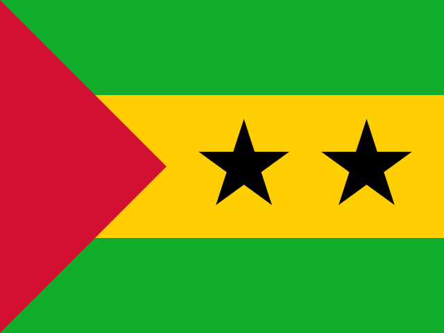
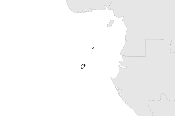
Flag of São Tomé and PríncipeSão Tomé and Príncipe in solid, land neighbours outlined, capital marked.
960 km² (371 sq mi) World Bank, surface area. 171st largest of 195.
Population density
250 people per km²
Land neighbours
None. It has no land borders with another country.
Official name
Democratic Republic of Sao Tome and Principe
UN status
Member state
Capital coordinates
0.33° N, 6.73° E São Tomé, Natural Earth.
No land borders
São Tomé and Príncipe shares no land border with another country. Its nearest neighbours are across the sea, as the map above shows.
From the Geography app
The app teaches each country through short hand written lenses: PLACE for physical geography, STORY for history and identity, NOW for the news, and THREAD for the ties between countries. Here is one of São Tomé and Príncipe's 5, in full.
PLACELens 1 of 5
Two islands on the equator
Sao Tome and Principe is a two-island nation in the Gulf of Guinea, straddling the equator about 250 kilometers off the coast of Gabon. Sao Tome, the larger island, covers roughly 850 square kilometers, while Principe to the north is just 136 square kilometers. Both are volcanic in origin, part of the Cameroon Line that extends from Mount Cameroon on the mainland into the Atlantic. Pico de Sao Tome, the highest point, reaches 2,024 meters and is often shrouded in cloud forest.
More on Cameroon Line
A chain of volcanic mountains and oceanic islands stretching 1,600 kilometers from the Nigerian highlands southwest into the Atlantic. It includes Mount Cameroon, Bioko (Equatorial Guinea), and the islands of Sao Tome, Principe, and Annobon, all formed by the same hotspot-like volcanic activity.
4 more lenses on São Tomé and Príncipe in the app
STORY A Creole society born from plantation labor
NOW Oil prospects and development dilemmas
THREAD A node in the Atlantic's colonial web
PLACE Volcanic peaks and endemic forests
Titles only. The app brings each lens back on a spaced repetition schedule set by how well you knew it: New, Hazy or Clear.
Compare São Tomé and Príncipe with another country
Opens the country comparison tool with population, area, income and more side by side, every figure dated.
Common questions
What is the capital of São Tomé and Príncipe?
The capital of São Tomé and Príncipe is São Tomé. São Tomé lies at about 0.3 degrees north and 6.7 degrees east. São Tomé and Príncipe is in Africa. It is home to about 240,000 people. The world capitals quiz on this site tests every capital, and the printable capitals sheets cover each continent.
What is the population of São Tomé and Príncipe?
About 240,000 people live in São Tomé and Príncipe, according to the World Bank figures for 2025. That makes it the 175th most populous of the 195 countries. With an area of 960 square kilometres, that is about 250 people per square kilometre.
What countries border São Tomé and Príncipe?
None. São Tomé and Príncipe has no land borders with any other country. It is surrounded by sea, so every neighbour of São Tomé and Príncipe is across the water. It lies in Africa. Its area is 960 square kilometres, and about 240,000 people live there.
How big is São Tomé and Príncipe?
São Tomé and Príncipe covers 960 square kilometres, or about 371 square miles. That makes it the 171st largest of the 195 countries. The figure is total surface area, which includes inland water such as lakes and rivers. Its population of about 240,000 gives a density of 250 people per square kilometre.
São Tomé and Príncipe is a country in Africa, with about 240,000 people (2025) and an area of 960 square kilometres. Its capital is São Tomé, and it has no land borders.
Capital
São Tomé
Continent
Africa
Population
240,254 2025, World Bank. 175th of 195.
Area
960 km² (371 sq mi) World Bank, surface area. 171st largest of 195.
Population density
250 people per km²
Land neighbours
None. It has no land borders with another country.
Official name
Democratic Republic of Sao Tome and Principe
UN status
Member state
PLACE · from the Geography app
Two islands on the equator
Sao Tome and Principe is a two-island nation in the Gulf of Guinea, straddling the equator about 250 kilometers off the coast of Gabon. Sao Tome, the larger island, covers roughly 850 square kilometers, while Principe to the north is just 136 square kilometers. Both are volcanic in origin, part of the Cameroon Line that extends from Mount Cameroon on the mainland into the Atlantic. Pico de Sao Tome, the highest point, reaches 2,024 meters and is often shrouded in cloud forest.
Keep going on your iPhone. Scan for Geography: the world, one country at a time, about five minutes a day. No quizzes and no streaks. playgeography.app/countries/sao-tome-and-principe/ · Map data: Natural Earth. Figures: World Bank and national sources, as listed on the page.
Geography · Country report
São Tomé and Príncipe
NameDate
Draw the flag
Colour São Tomé and Príncipe on the map, then fill in what you find.
Capital
Continent
Population
Area
Languages
Currency
Neighbours
Landmarks
Rivers or mountains
Three things I learned
1
2
3
One question I still have
?
Keep going on your iPhone. Scan for Geography: the world, one country at a time, about five minutes a day. No quizzes and no streaks. playgeography.app/countries/sao-tome-and-principe/ · Map data: Natural Earth. Figures: World Bank and national sources, as listed on the page.