Key facts about Antigua and Barbuda
| Capital | Saint John's |
|---|---|
| Continent | North America |
| Region | Central America and the Caribbean |
| Population | 94,209 2025, World Bank. 184th of 195. |
| Area | 440 km² (170 sq mi) World Bank, surface area. 182nd largest of 195. |
| Population density | 214 people per km² |
| Land neighbours | None. It has no land borders with another country. |
| UN status | Member state |
| Capital coordinates | 17.12° N, 61.85° W Saint John's, Natural Earth. |
No land borders
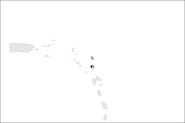
Antigua and Barbuda shares no land border with another country. Its nearest neighbours are across the sea, as the map above shows.
From the Geography app
The app teaches each country through short hand written lenses: PLACE for physical geography, STORY for history and identity, NOW for the news, and THREAD for the ties between countries. Here is one of Antigua and Barbuda's 5, in full.
A dry island with a perfect harbor
Antigua sits on the outer arc of the Leeward Islands, where the Atlantic Ocean meets the Caribbean Sea. It is low and porous: limestone north and east, clay through the middle, a volcanic corner rising to 402 meters at Boggy Peak. Rain averages under a thousand millimeters a year and there are no permanent rivers, so the island has long imported or manufactured its water. English Harbour, on the south coast, is one of the best protected natural harbors in the Eastern Caribbean.
More on English Harbour
The Royal Navy built a dockyard at English Harbour from the 1740s because the inlet is deep, narrow and ringed by hills, which makes it a hurricane refuge. In 1723 a storm damaged thirty five ships elsewhere on Antigua and left the vessels inside untouched. Horatio Nelson served there from 1784. The Georgian yard survives and now works as a marina.
4 more lenses on Antigua and Barbuda in the app
Titles only. The app brings each lens back on a spaced repetition schedule set by how well you knew it: New, Hazy or Clear.
Compare Antigua and Barbuda with another country
Opens the country comparison tool with population, area, income and more side by side, every figure dated.