Lesotho is a country in Africa, in Southern Africa, with about 2.36 million people (2025) and an area of 30,360 square kilometres. Its capital is Maseru, and its only land neighbour is South Africa.
By Team Geography·Last reviewed
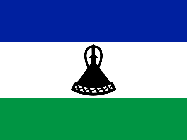
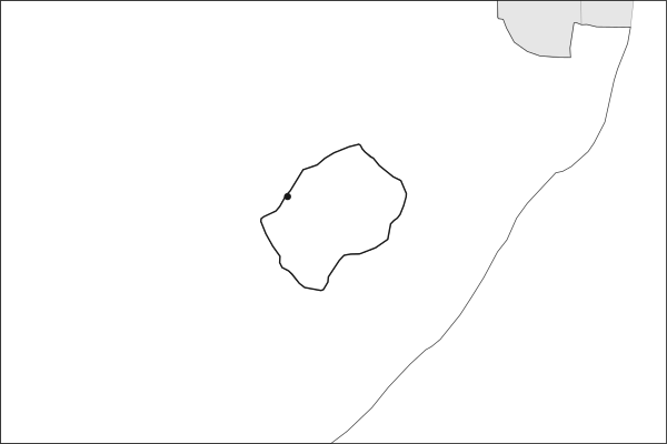
Flag of LesothoLesotho in solid, land neighbours outlined, capital marked.
The app teaches each country through short hand written lenses: PLACE for physical geography, STORY for history and identity, NOW for the news, and THREAD for the ties between countries. Here is one of Lesotho's 6, in full.
PLACELens 1 of 6
The country that never drops below 1,000 meters
Lesotho is the only country whose entire territory lies above 1,000 meters, which earned it the name Kingdom in the Sky. South Africa surrounds it completely, one of only three enclaved states on Earth. The western lowlands sit near 1,500 meters; the eastern highlands along the Drakensberg escarpment rise past 3,400 meters at Thabana Ntlenyana, the highest peak in southern Africa. The Orange River, South Africa's longest, begins in those highlands before crossing the subcontinent west to the Atlantic.
More on Drakensberg escarpment
The eastern wall of the southern African plateau. The escarpment falls away sharply into the KwaZulu-Natal lowlands of South Africa, and its basalt cliffs are a UNESCO World Heritage Site. On the Lesotho side the land never falls below about 1,400 meters, at the point where the Makhaleng meets the Orange, the highest national low point on Earth.
5 more lenses on Lesotho in the app
STORY A mountain kingdom that survived colonialism intact
NOW Water is Lesotho's most valuable export
STORY The Basotho blanket as national uniform
THREAD An enclave whose fate is inseparable from South Africa
THREAD Altitude is leverage, even for a poor country
Titles only. The app brings each lens back on a spaced repetition schedule set by how well you knew it: New, Hazy or Clear.
Compare Lesotho with another country
Opens the country comparison tool with population, area, income and more side by side, every figure dated.
Common questions
What is the capital of Lesotho?
The capital of Lesotho is Maseru. Maseru lies at about 29.3 degrees south and 27.5 degrees east. Lesotho is in Africa, in the region often called Southern Africa. It is home to about 2.36 million people. The world capitals quiz on this site tests every capital, and the printable capitals sheets cover each continent.
What is the population of Lesotho?
About 2.36 million people live in Lesotho, according to the World Bank figures for 2025. That makes it the 142nd most populous of the 195 countries. With an area of 30,360 square kilometres, that is about 78 people per square kilometre.
What countries border Lesotho?
Lesotho shares land borders with 1 country: South Africa. The map on this page outlines each of them around Lesotho. The count includes only borders on land, not neighbours across a sea or a lake. Borders here follow Natural Earth at the 1:50 million scale, with Crimea shown as part of Ukraine and Western Sahara as a separate territory.
How big is Lesotho?
Lesotho covers 30,360 square kilometres, or about 11,722 square miles. That makes it the 137th largest of the 195 countries. The figure is total surface area, which includes inland water such as lakes and rivers. Its population of about 2.36 million gives a density of 78 people per square kilometre.
Lesotho is a country in Africa, in Southern Africa, with about 2.36 million people (2025) and an area of 30,360 square kilometres. Its capital is Maseru, and its only land neighbour is South Africa.
Capital
Maseru
Continent
Africa
Region
Southern Africa
Population
2,363,325 2025, World Bank. 142nd of 195.
Area
30,360 km² (11,722 sq mi) World Bank, surface area. 137th largest of 195.
Population density
78 people per km²
Land neighbours
1: South Africa
Official name
Kingdom of Lesotho
UN status
Member state
PLACE · from the Geography app
The country that never drops below 1,000 meters
Lesotho is the only country whose entire territory lies above 1,000 meters, which earned it the name Kingdom in the Sky. South Africa surrounds it completely, one of only three enclaved states on Earth. The western lowlands sit near 1,500 meters; the eastern highlands along the Drakensberg escarpment rise past 3,400 meters at Thabana Ntlenyana, the highest peak in southern Africa. The Orange River, South Africa's longest, begins in those highlands before crossing the subcontinent west to the Atlantic.
Keep going on your iPhone. Scan for Geography: the world, one country at a time, about five minutes a day. No quizzes and no streaks. playgeography.app/countries/lesotho/ · Map data: Natural Earth. Figures: World Bank and national sources, as listed on the page.
Geography · Country report
Lesotho
NameDate
Draw the flag
Colour Lesotho on the map, then fill in what you find.
Capital
Continent
Population
Area
Languages
Currency
Neighbours
Landmarks
Rivers or mountains
Three things I learned
1
2
3
One question I still have
?
Keep going on your iPhone. Scan for Geography: the world, one country at a time, about five minutes a day. No quizzes and no streaks. playgeography.app/countries/lesotho/ · Map data: Natural Earth. Figures: World Bank and national sources, as listed on the page.