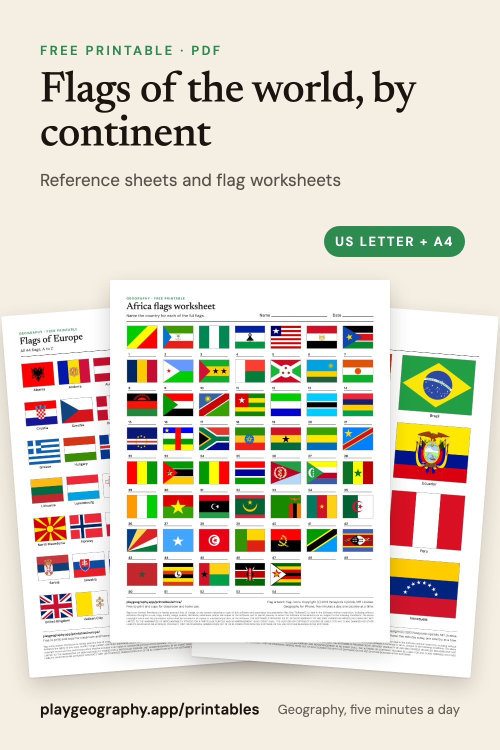
All 195 in one file
By continent
Africa, 54 flags
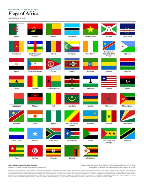
Flags of Africa
All 54 flags of Africa, named, in alphabetical order.
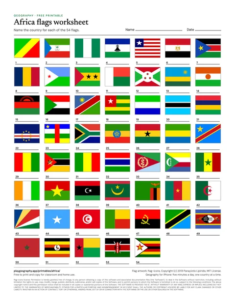
Africa flags worksheet
Name all 54 flags, in shuffled order. Page two is the answer key.
Asia, 48 flags
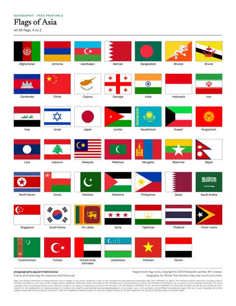
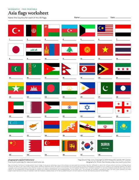
Asia flags worksheet
Name all 48 flags, in shuffled order. Page two is the answer key.
Europe, 44 flags
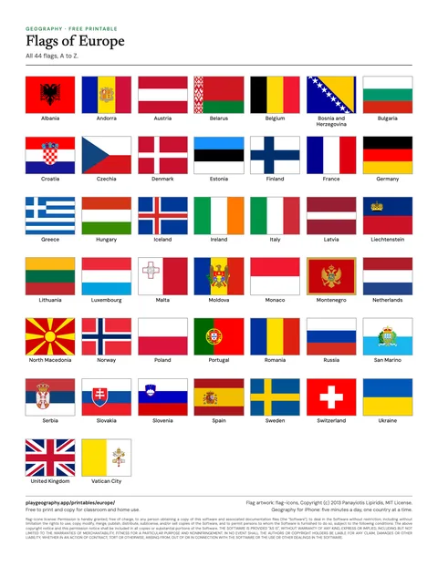
Flags of Europe
All 44 flags of Europe, named, in alphabetical order.
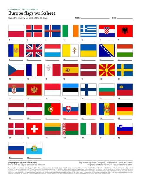
Europe flags worksheet
Name all 44 flags, in shuffled order. Page two is the answer key.
North America, 23 flags
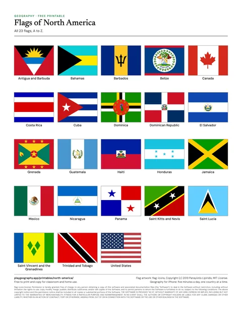
Flags of North America
All 23 flags of North America, named, in alphabetical order.
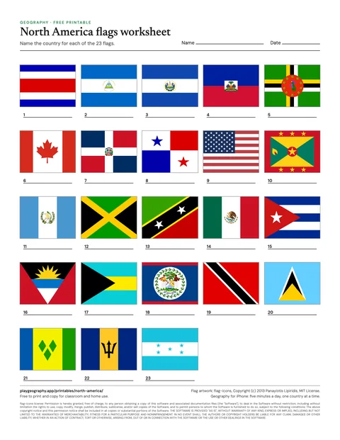
North America flags worksheet
Name all 23 flags, in shuffled order. Page two is the answer key.
South America, 12 flags
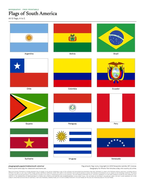
Flags of South America
All 12 flags of South America, named, in alphabetical order.
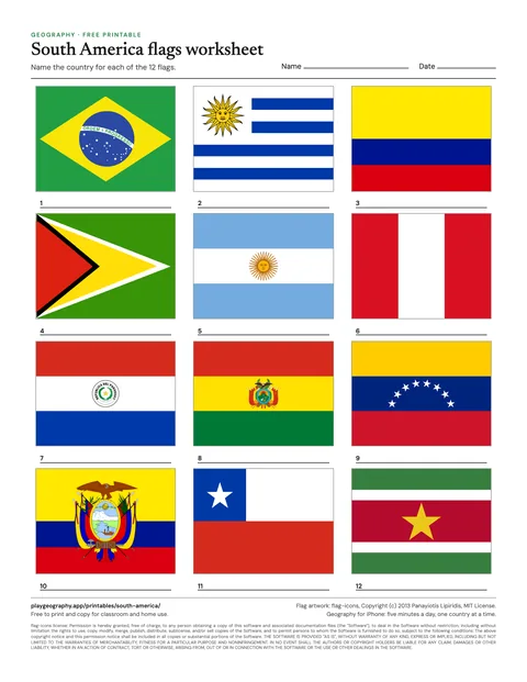
South America flags worksheet
Name all 12 flags, in shuffled order. Page two is the answer key.
Oceania, 14 flags
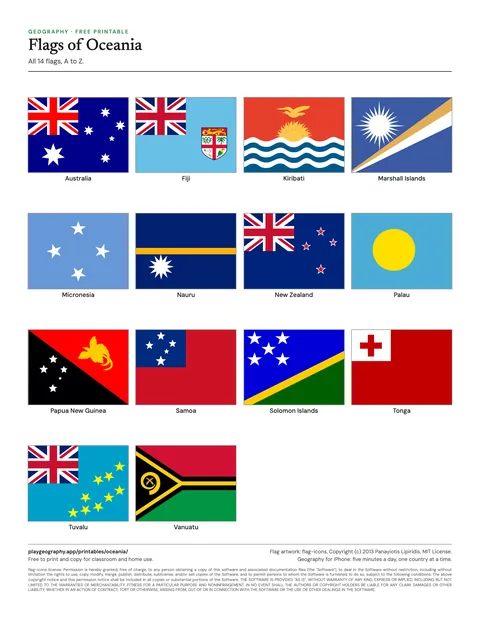
Flags of Oceania
All 14 flags of Oceania, named, in alphabetical order.
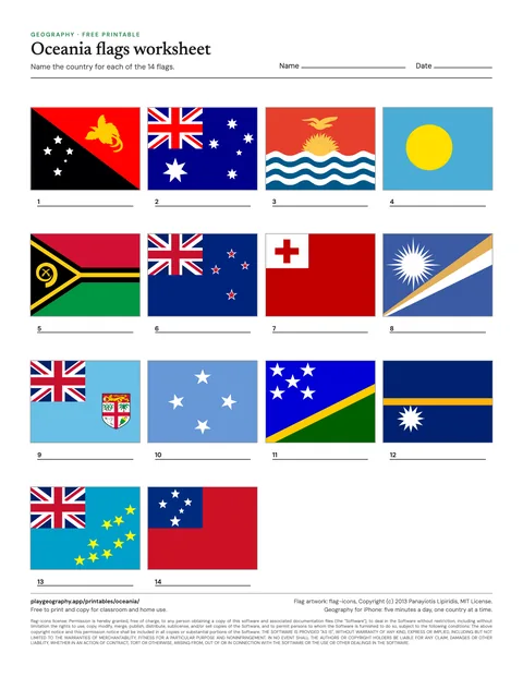
Oceania flags worksheet
Name all 14 flags, in shuffled order. Page two is the answer key.
Using the flag sheets
The reference sheet shows every flag of a continent in alphabetical order with its country name. The worksheet shuffles the same flags and numbers them, with a blank line under each, so the order gives nothing away; the answer key on page two uses the same numbering. Flags print best in color.
Some pairs are near twins, which makes them good discussion material: Chad and Romania, Indonesia and Monaco, the Netherlands and Luxembourg. Countries with similar flags sets them side by side, and why countries have flags is a short read for the start of a lesson.