Ireland is a country in Europe, with about 5.48 million people (2025) and an area of 70,280 square kilometres. Its capital is Dublin, and its only land neighbour is the United Kingdom.
By Team Geography·Last reviewed
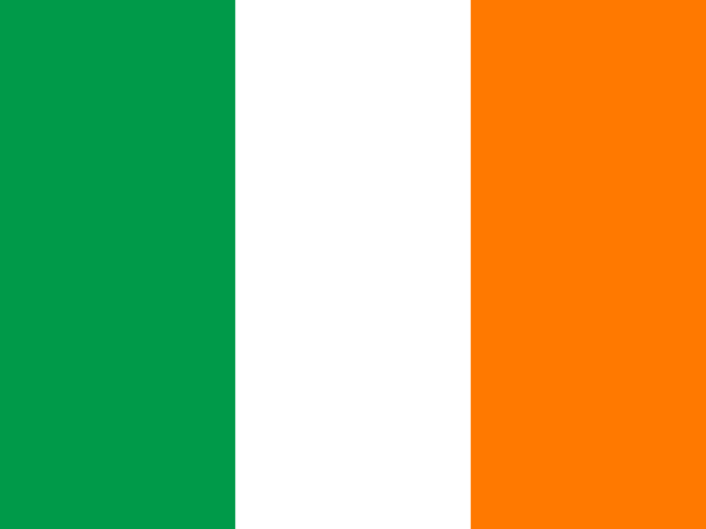
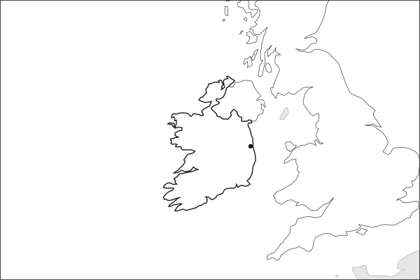
Flag of IrelandIreland in solid, land neighbours outlined, capital marked.
The app teaches each country through short hand written lenses: PLACE for physical geography, STORY for history and identity, NOW for the news, and THREAD for the ties between countries. Here is one of Ireland's 5, in full.
PLACELens 1 of 5
Europe's Atlantic edge
Ireland lies on the western fringe of Europe, separated from Great Britain by the narrow Irish Sea and facing the open Atlantic. The island covers 84,421 square kilometers; the Republic holds about 83 percent, the rest forming Northern Ireland, part of the United Kingdom. A central limestone lowland of bogs and lakes fills the interior; the coastline, over 7,500 kilometers, is scalloped with bays, cliffs, and peninsulas. The Shannon, at 360 kilometers the longest river in Ireland or Britain, drains the western midlands.
More on Shannon River
The Shannon rises in the Cuilcagh Mountains near the border with Northern Ireland and flows south and west to its estuary on the Atlantic coast. Its broad, slow course created natural barriers that shaped early Irish political geography. The Shannon hydroelectric scheme, completed at Ardnacrusha in 1929, was one of the young Irish state's most ambitious infrastructure projects.
4 more lenses on Ireland in the app
STORY From famine to independence
NOW Europe's corporate tax haven
THREAD A diaspora that shaped the world
STORY The Irish language and cultural revival
Titles only. The app brings each lens back on a spaced repetition schedule set by how well you knew it: New, Hazy or Clear.
Compare Ireland with another country
Opens the country comparison tool with population, area, income and more side by side, every figure dated.
Common questions
What is the capital of Ireland?
The capital of Ireland is Dublin. Dublin lies at about 53.3 degrees north and 6.3 degrees west. Ireland is in Europe. It is home to about 5.48 million people. The world capitals quiz on this site tests every capital, and the printable capitals sheets cover each continent.
What is the population of Ireland?
About 5.48 million people live in Ireland, according to the World Bank figures for 2025. That makes it the 120th most populous of the 195 countries. With an area of 70,280 square kilometres, that is about 78 people per square kilometre.
What countries border Ireland?
Ireland shares land borders with 1 country: United Kingdom. The map on this page outlines each of them around Ireland. The count includes only borders on land, not neighbours across a sea or a lake. Borders here follow Natural Earth at the 1:50 million scale, with Crimea shown as part of Ukraine and Western Sahara as a separate territory.
How big is Ireland?
Ireland covers 70,280 square kilometres, or about 27,135 square miles. That makes it the 120th largest of the 195 countries. The figure is total surface area, which includes inland water such as lakes and rivers. Its population of about 5.48 million gives a density of 78 people per square kilometre.
Ireland is a country in Europe, with about 5.48 million people (2025) and an area of 70,280 square kilometres. Its capital is Dublin, and its only land neighbour is the United Kingdom.
Capital
Dublin
Continent
Europe
Population
5,484,367 2025, World Bank. 120th of 195.
Area
70,280 km² (27,135 sq mi) World Bank, surface area. 120th largest of 195.
Population density
78 people per km²
Land neighbours
1: United Kingdom
Official name
Republic of Ireland
UN status
Member state
PLACE · from the Geography app
Europe's Atlantic edge
Ireland lies on the western fringe of Europe, separated from Great Britain by the narrow Irish Sea and facing the open Atlantic. The island covers 84,421 square kilometers; the Republic holds about 83 percent, the rest forming Northern Ireland, part of the United Kingdom. A central limestone lowland of bogs and lakes fills the interior; the coastline, over 7,500 kilometers, is scalloped with bays, cliffs, and peninsulas. The Shannon, at 360 kilometers the longest river in Ireland or Britain, drains the western midlands.
Keep going on your iPhone. Scan for Geography: the world, one country at a time, about five minutes a day. No quizzes and no streaks. playgeography.app/countries/ireland/ · Map data: Natural Earth. Figures: World Bank and national sources, as listed on the page.
Geography · Country report
Ireland
NameDate
Draw the flag
Colour Ireland on the map, then fill in what you find.
Capital
Continent
Population
Area
Languages
Currency
Neighbours
Landmarks
Rivers or mountains
Three things I learned
1
2
3
One question I still have
?
Keep going on your iPhone. Scan for Geography: the world, one country at a time, about five minutes a day. No quizzes and no streaks. playgeography.app/countries/ireland/ · Map data: Natural Earth. Figures: World Bank and national sources, as listed on the page.