Madagascar is a country in Africa, in East Africa, with about 32.7 million people (2025) and an area of 587,295 square kilometres. Its capital is Antananarivo, and it has no land borders.
By Team Geography·Last reviewed
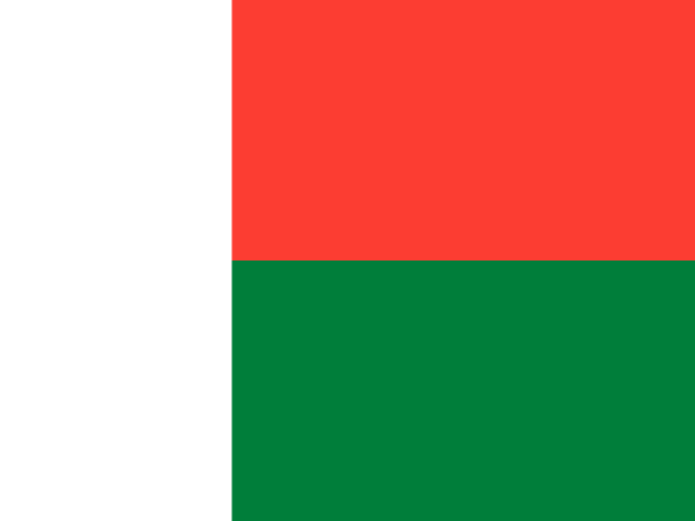
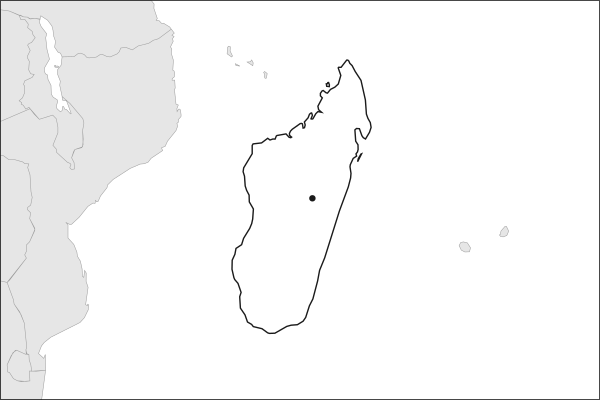
Flag of MadagascarMadagascar in solid, land neighbours outlined, capital marked.
587,295 km² (226,756 sq mi) World Bank, surface area. 48th largest of 195.
Population density
56 people per km²
Land neighbours
None. It has no land borders with another country.
Official name
Republic of Madagascar
UN status
Member state
Capital coordinates
18.91° S, 47.51° E Antananarivo, Natural Earth.
No land borders
Madagascar shares no land border with another country. Its nearest neighbours are across the sea, as the map above shows.
From the Geography app
The app teaches each country through short hand written lenses: PLACE for physical geography, STORY for history and identity, NOW for the news, and THREAD for the ties between countries. Here is one of Madagascar's 7, in full.
PLACELens 1 of 7
How did Madagascar become an island apart?
Madagascar separated from the Indian subcontinent roughly 88 million years ago and has been isolated in the western Indian Ocean ever since, lying about 400 kilometers east of Mozambique across the Mozambique Channel. It is the world's fourth-largest island, stretching 1,580 km from north to south. A spine of central highlands, rising above 1,500 meters, divides a humid eastern rainforest belt from drier western deciduous forests and the arid south, creating a remarkable range of climates on a single landmass.
More on central highlands
A plateau region averaging 1,200 to 1,500 meters in elevation, home to the capital Antananarivo and the majority of Madagascar's population. Centuries of slash-and-burn agriculture have left much of the highlands covered in grassland rather than forest.
6 more lenses on Madagascar in the app
STORY What makes Malagasy culture so unusual?
NOW Why is Madagascar's biodiversity in crisis?
THREAD How does Madagascar connect to the wider world?
PLACE What geological wonders mark Madagascar's landscape?
NOW Two cyclones, and the harbor that mattered
THREAD The islets France kept when Madagascar left
Titles only. The app brings each lens back on a spaced repetition schedule set by how well you knew it: New, Hazy or Clear.
Compare Madagascar with another country
Opens the country comparison tool with population, area, income and more side by side, every figure dated.
Common questions
What is the capital of Madagascar?
The capital of Madagascar is Antananarivo. Antananarivo lies at about 18.9 degrees south and 47.5 degrees east. Madagascar is in Africa, in the region often called East Africa. It is home to about 32.7 million people. The world capitals quiz on this site tests every capital, and the printable capitals sheets cover each continent.
What is the population of Madagascar?
About 32.7 million people live in Madagascar, according to the World Bank figures for 2025. That makes it the 49th most populous of the 195 countries. With an area of 587,295 square kilometres, that is about 56 people per square kilometre.
What countries border Madagascar?
None. Madagascar has no land borders with any other country. It is surrounded by sea, so every neighbour of Madagascar is across the water. It lies in Africa, in the region often called East Africa. Its area is 587,295 square kilometres, and about 32.7 million people live there.
How big is Madagascar?
Madagascar covers 587,295 square kilometres, or about 226,756 square miles. That makes it the 48th largest of the 195 countries. The figure is total surface area, which includes inland water such as lakes and rivers. Its population of about 32.7 million gives a density of 56 people per square kilometre.
Madagascar is a country in Africa, in East Africa, with about 32.7 million people (2025) and an area of 587,295 square kilometres. Its capital is Antananarivo, and it has no land borders.
Capital
Antananarivo
Continent
Africa
Region
East Africa
Population
32,740,678 2025, World Bank. 49th of 195.
Area
587,295 km² (226,756 sq mi) World Bank, surface area. 48th largest of 195.
Population density
56 people per km²
Land neighbours
None. It has no land borders with another country.
Official name
Republic of Madagascar
UN status
Member state
PLACE · from the Geography app
How did Madagascar become an island apart?
Madagascar separated from the Indian subcontinent roughly 88 million years ago and has been isolated in the western Indian Ocean ever since, lying about 400 kilometers east of Mozambique across the Mozambique Channel. It is the world's fourth-largest island, stretching 1,580 km from north to south. A spine of central highlands, rising above 1,500 meters, divides a humid eastern rainforest belt from drier western deciduous forests and the arid south, creating a remarkable range of climates on a single landmass.
Keep going on your iPhone. Scan for Geography: the world, one country at a time, about five minutes a day. No quizzes and no streaks. playgeography.app/countries/madagascar/ · Map data: Natural Earth. Figures: World Bank and national sources, as listed on the page.
Geography · Country report
Madagascar
NameDate
Draw the flag
Colour Madagascar on the map, then fill in what you find.
Capital
Continent
Population
Area
Languages
Currency
Neighbours
Landmarks
Rivers or mountains
Three things I learned
1
2
3
One question I still have
?
Keep going on your iPhone. Scan for Geography: the world, one country at a time, about five minutes a day. No quizzes and no streaks. playgeography.app/countries/madagascar/ · Map data: Natural Earth. Figures: World Bank and national sources, as listed on the page.