Mauritius is a country in Africa, in East Africa, with about 1.24 million people (2025) and an area of 2,010 square kilometres. Its capital is Port Louis, and it has no land borders.
By Team Geography·Last reviewed
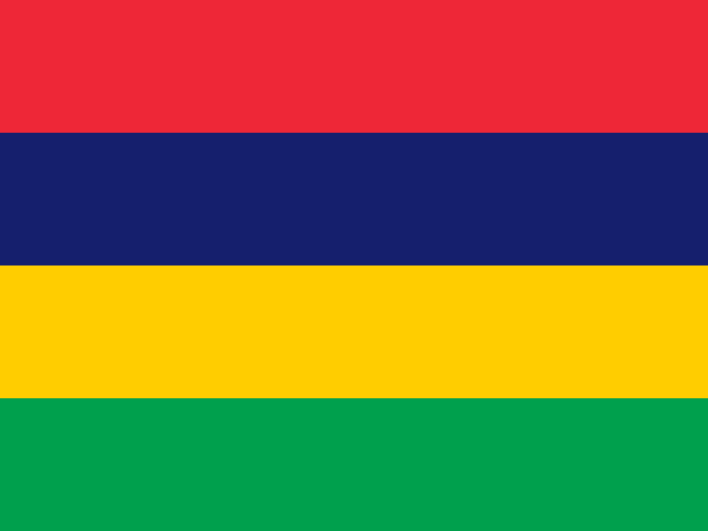
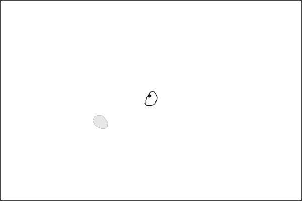
Flag of MauritiusMauritius in solid, land neighbours outlined, capital marked.
2,010 km² (776 sq mi) World Bank, surface area. 169th largest of 195.
Population density
619 people per km²
Land neighbours
None. It has no land borders with another country.
Official name
Republic of Mauritius
UN status
Member state
Capital coordinates
20.17° S, 57.50° E Port Louis, Natural Earth.
No land borders
Mauritius shares no land border with another country. Its nearest neighbours are across the sea, as the map above shows.
From the Geography app
The app teaches each country through short hand written lenses: PLACE for physical geography, STORY for history and identity, NOW for the news, and THREAD for the ties between countries. Here is one of Mauritius's 6, in full.
PLACELens 1 of 6
A volcanic dot in the Indian Ocean
Mauritius lies about 2,000 kilometers off the southeast coast of Africa, east of Madagascar. The main island is volcanic, roughly 65 kilometers long and 45 wide, ringed by coral reefs that hold calm lagoons along much of the coastline. The interior rises to a central plateau near 600 meters, and the highest point, Piton de la Petite Riviere Noire, reaches 828 meters. The republic also administers Rodrigues Island, 560 kilometers to the east, along with the Agalega Islands and the Cargados Carajos shoals.
More on Rodrigues Island
An autonomous outer island of Mauritius with about 43,000 residents. It is smaller, more rural, and geologically older than the main island. Rodrigues was once home to the solitaire, a flightless bird related to the dodo that went extinct in the 18th century.
5 more lenses on Mauritius in the app
STORY Forged from migration, not conquest
NOW An economic miracle, recalibrated
THREAD Indian Ocean crossroads
PLACE Reef, plateau, and remnant forest
THREAD The ships that replaced the slave ships
Titles only. The app brings each lens back on a spaced repetition schedule set by how well you knew it: New, Hazy or Clear.
Compare Mauritius with another country
Opens the country comparison tool with population, area, income and more side by side, every figure dated.
Common questions
What is the capital of Mauritius?
The capital of Mauritius is Port Louis. Port Louis lies at about 20.2 degrees south and 57.5 degrees east. Mauritius is in Africa, in the region often called East Africa. It is home to about 1.24 million people. The world capitals quiz on this site tests every capital, and the printable capitals sheets cover each continent.
What is the population of Mauritius?
About 1.24 million people live in Mauritius, according to the World Bank figures for 2025. That makes it the 156th most populous of the 195 countries. With an area of 2,010 square kilometres, that is about 619 people per square kilometre.
What countries border Mauritius?
None. Mauritius has no land borders with any other country. It is surrounded by sea, so every neighbour of Mauritius is across the water. It lies in Africa, in the region often called East Africa. Its area is 2,010 square kilometres, and about 1.24 million people live there.
How big is Mauritius?
Mauritius covers 2,010 square kilometres, or about 776 square miles. That makes it the 169th largest of the 195 countries. The figure is total surface area, which includes inland water such as lakes and rivers. Its population of about 1.24 million gives a density of 619 people per square kilometre.
Mauritius is a country in Africa, in East Africa, with about 1.24 million people (2025) and an area of 2,010 square kilometres. Its capital is Port Louis, and it has no land borders.
Capital
Port Louis
Continent
Africa
Region
East Africa
Population
1,243,741 2025, World Bank. 156th of 195.
Area
2,010 km² (776 sq mi) World Bank, surface area. 169th largest of 195.
Population density
619 people per km²
Land neighbours
None. It has no land borders with another country.
Official name
Republic of Mauritius
UN status
Member state
PLACE · from the Geography app
A volcanic dot in the Indian Ocean
Mauritius lies about 2,000 kilometers off the southeast coast of Africa, east of Madagascar. The main island is volcanic, roughly 65 kilometers long and 45 wide, ringed by coral reefs that hold calm lagoons along much of the coastline. The interior rises to a central plateau near 600 meters, and the highest point, Piton de la Petite Riviere Noire, reaches 828 meters. The republic also administers Rodrigues Island, 560 kilometers to the east, along with the Agalega Islands and the Cargados Carajos shoals.
Keep going on your iPhone. Scan for Geography: the world, one country at a time, about five minutes a day. No quizzes and no streaks. playgeography.app/countries/mauritius/ · Map data: Natural Earth. Figures: World Bank and national sources, as listed on the page.
Geography · Country report
Mauritius
NameDate
Draw the flag
Colour Mauritius on the map, then fill in what you find.
Capital
Continent
Population
Area
Languages
Currency
Neighbours
Landmarks
Rivers or mountains
Three things I learned
1
2
3
One question I still have
?
Keep going on your iPhone. Scan for Geography: the world, one country at a time, about five minutes a day. No quizzes and no streaks. playgeography.app/countries/mauritius/ · Map data: Natural Earth. Figures: World Bank and national sources, as listed on the page.