Benin is a country in Africa, in West Africa, with about 14.8 million people (2025) and an area of 114,760 square kilometres. It names 2 capitals, Porto-Novo and Cotonou, and it shares land borders with 4 countries.
By Team Geography·Last reviewed
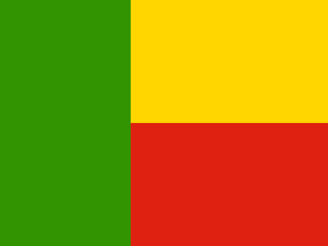
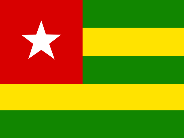
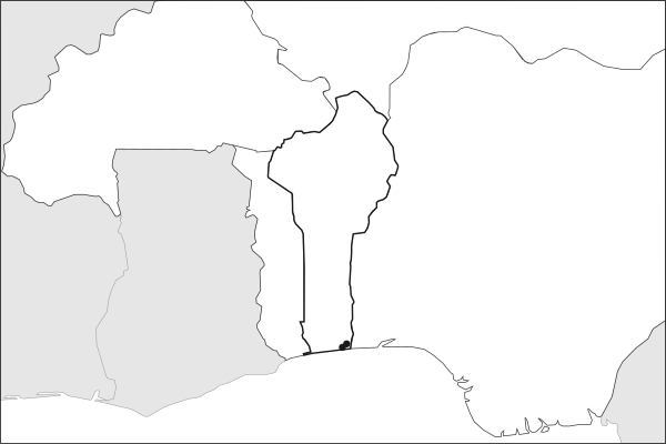
Flag of BeninBenin in solid, land neighbours outlined, capital marked.
Key facts about Benin
Capitals
Porto-Novo and CotonouPorto-Novo is the official capital; Cotonou is the seat of government.
The app teaches each country through short hand written lenses: PLACE for physical geography, STORY for history and identity, NOW for the news, and THREAD for the ties between countries. Here is one of Benin's 5, in full.
PLACELens 1 of 5
A narrow corridor from the Sahel to the sea
Benin runs about 700 kilometers north from the sandy Gulf of Guinea coast into the semi-arid Sahel, and at its widest spans only 325 kilometers. The shape bridges two ecological and cultural zones: a humid, densely populated south anchored by Cotonou, the commercial capital, and a drier, pastoral north closer to landlocked Niger than to the Atlantic. The port of Cotonou carries transit trade for Niger and other Sahelian neighbors, giving Benin an economic role beyond its size.
More on port of Cotonou
One of West Africa's busiest ports, Cotonou's autonomous port also handles cargo for Burkina Faso and northern Nigeria. Port revenue and transit fees are a major source of government income.
4 more lenses on Benin in the app
STORY The birthplace of Vodun
STORY From Marxist state to democratic pioneer
NOW Cotton, cashews, and a bet on heritage tourism
THREAD Benin lives in the shadow of Nigeria and bridges the Sahel to the sea
Titles only. The app brings each lens back on a spaced repetition schedule set by how well you knew it: New, Hazy or Clear.
Compare Benin with another country
Opens the country comparison tool with population, area, income and more side by side, every figure dated.
Common questions
What is the capital of Benin?
Benin names 2 capitals: Porto-Novo and Cotonou. Porto-Novo is the official capital; Cotonou is the seat of government. Porto-Novo lies at about 6.5 degrees north and 2.6 degrees east. Benin is in Africa, in the region often called West Africa.
What is the population of Benin?
About 14.8 million people live in Benin, according to the World Bank figures for 2025. That makes it the 75th most populous of the 195 countries. With an area of 114,760 square kilometres, that is about 129 people per square kilometre.
What countries border Benin?
Benin shares land borders with 4 countries: Burkina Faso, Niger, Nigeria and Togo. The map on this page outlines each of them around Benin. The count includes only borders on land, not neighbours across a sea or a lake. Borders here follow Natural Earth at the 1:50 million scale, with Crimea shown as part of Ukraine and Western Sahara as a separate territory.
How big is Benin?
Benin covers 114,760 square kilometres, or about 44,309 square miles. That makes it the 101st largest of the 195 countries. The figure is total surface area, which includes inland water such as lakes and rivers. Its population of about 14.8 million gives a density of 129 people per square kilometre.
Benin is a country in Africa, in West Africa, with about 14.8 million people (2025) and an area of 114,760 square kilometres. It names 2 capitals, Porto-Novo and Cotonou, and it shares land borders with 4 countries.
Capitals
Porto-Novo and CotonouPorto-Novo is the official capital; Cotonou is the seat of government.
Continent
Africa
Region
West Africa
Population
14,814,460 2025, World Bank. 75th of 195.
Area
114,760 km² (44,309 sq mi) World Bank, surface area. 101st largest of 195.
Population density
129 people per km²
Land neighbours
4: Burkina Faso, Niger, Nigeria, Togo
Official name
Republic of Benin
UN status
Member state
PLACE · from the Geography app
A narrow corridor from the Sahel to the sea
Benin runs about 700 kilometers north from the sandy Gulf of Guinea coast into the semi-arid Sahel, and at its widest spans only 325 kilometers. The shape bridges two ecological and cultural zones: a humid, densely populated south anchored by Cotonou, the commercial capital, and a drier, pastoral north closer to landlocked Niger than to the Atlantic. The port of Cotonou carries transit trade for Niger and other Sahelian neighbors, giving Benin an economic role beyond its size.
Keep going on your iPhone. Scan for Geography: the world, one country at a time, about five minutes a day. No quizzes and no streaks. playgeography.app/countries/benin/ · Map data: Natural Earth. Figures: World Bank and national sources, as listed on the page.
Geography · Country report
Benin
NameDate
Draw the flag
Colour Benin on the map, then fill in what you find.
Capital
Continent
Population
Area
Languages
Currency
Neighbours
Landmarks
Rivers or mountains
Three things I learned
1
2
3
One question I still have
?
Keep going on your iPhone. Scan for Geography: the world, one country at a time, about five minutes a day. No quizzes and no streaks. playgeography.app/countries/benin/ · Map data: Natural Earth. Figures: World Bank and national sources, as listed on the page.