Slovenia is a country in Europe, in The Balkans, with about 2.13 million people (2025) and an area of 20,480 square kilometres. Its capital is Ljubljana, and it shares land borders with 4 countries.
By Team Geography·Last reviewed
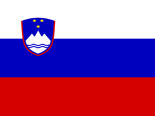
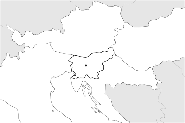
Flag of SloveniaSlovenia in solid, land neighbours outlined, capital marked.
The app teaches each country through short hand written lenses: PLACE for physical geography, STORY for history and identity, NOW for the news, and THREAD for the ties between countries. Here is one of Slovenia's 5, in full.
PLACELens 1 of 5
Where Slovenia sits on the map
Slovenia sits where four regions meet: the Alps to the northwest, the Pannonian Plain to the northeast, the Dinaric Alps to the south, and the Mediterranean to the southwest. In 20,273 square kilometers, roughly the size of New Jersey, it fits Alpine peaks above 2,800 meters, 46 kilometers of Adriatic coastline, and extensive cave systems. Mount Triglav, at 2,864 meters the highest peak in the Julian Alps, appears on the flag and coat of arms. The capital, Ljubljana, sits centrally on the Ljubljanica River.
More on Julian Alps
Named after Julius Caesar, who founded the nearby Roman colony of Forum Julii, the Julian Alps straddle the Slovenia-Italy border. Triglav National Park, Slovenia's only national park, protects much of the range and covers over 4% of the country's total area. The Soca River, known for its striking emerald color, originates in the park.
4 more lenses on Slovenia in the app
STORY Slovenia's quiet distinctness
NOW First to the euro, and still mostly forest
THREAD A seaport for countries that have no sea
STORY Slovenia's apiculture tradition
Titles only. The app brings each lens back on a spaced repetition schedule set by how well you knew it: New, Hazy or Clear.
Compare Slovenia with another country
Opens the country comparison tool with population, area, income and more side by side, every figure dated.
Common questions
What is the capital of Slovenia?
The capital of Slovenia is Ljubljana. Ljubljana lies at about 46.1 degrees north and 14.5 degrees east. Slovenia is in Europe, in the region often called The Balkans. It is home to about 2.13 million people. The world capitals quiz on this site tests every capital, and the printable capitals sheets cover each continent.
What is the population of Slovenia?
About 2.13 million people live in Slovenia, according to the World Bank figures for 2025. That makes it the 146th most populous of the 195 countries. With an area of 20,480 square kilometres, that is about 104 people per square kilometre.
What countries border Slovenia?
Slovenia shares land borders with 4 countries: Austria, Croatia, Hungary and Italy. The map on this page outlines each of them around Slovenia. The count includes only borders on land, not neighbours across a sea or a lake. Borders here follow Natural Earth at the 1:50 million scale, with Crimea shown as part of Ukraine and Western Sahara as a separate territory.
How big is Slovenia?
Slovenia covers 20,480 square kilometres, or about 7,907 square miles. That makes it the 150th largest of the 195 countries. The figure is total surface area, which includes inland water such as lakes and rivers. Its population of about 2.13 million gives a density of 104 people per square kilometre.
Slovenia is a country in Europe, in The Balkans, with about 2.13 million people (2025) and an area of 20,480 square kilometres. Its capital is Ljubljana, and it shares land borders with 4 countries.
Capital
Ljubljana
Continent
Europe
Region
The Balkans
Population
2,130,986 2025, World Bank. 146th of 195.
Area
20,480 km² (7,907 sq mi) World Bank, surface area. 150th largest of 195.
Population density
104 people per km²
Land neighbours
4: Austria, Croatia, Hungary, Italy
Official name
Republic of Slovenia
UN status
Member state
PLACE · from the Geography app
Where Slovenia sits on the map
Slovenia sits where four regions meet: the Alps to the northwest, the Pannonian Plain to the northeast, the Dinaric Alps to the south, and the Mediterranean to the southwest. In 20,273 square kilometers, roughly the size of New Jersey, it fits Alpine peaks above 2,800 meters, 46 kilometers of Adriatic coastline, and extensive cave systems. Mount Triglav, at 2,864 meters the highest peak in the Julian Alps, appears on the flag and coat of arms. The capital, Ljubljana, sits centrally on the Ljubljanica River.
Keep going on your iPhone. Scan for Geography: the world, one country at a time, about five minutes a day. No quizzes and no streaks. playgeography.app/countries/slovenia/ · Map data: Natural Earth. Figures: World Bank and national sources, as listed on the page.
Geography · Country report
Slovenia
NameDate
Draw the flag
Colour Slovenia on the map, then fill in what you find.
Capital
Continent
Population
Area
Languages
Currency
Neighbours
Landmarks
Rivers or mountains
Three things I learned
1
2
3
One question I still have
?
Keep going on your iPhone. Scan for Geography: the world, one country at a time, about five minutes a day. No quizzes and no streaks. playgeography.app/countries/slovenia/ · Map data: Natural Earth. Figures: World Bank and national sources, as listed on the page.